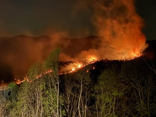
After several days of efforts and improved weather conditions, significant progress has been made in containment of the three wildfires burning in Western North Carolina.
Two of the fires, burning in McDowell and Swain counties, are at 94% and 100% containment, respectively. The third wildfire in Nantahala National Forest remains at 29% containment, but has reportedly not grown in acreage over the past 24 hours.
Here’s what else we know about the three wildfires.
Western North Carolina wildfires
Three large wildfires are currently burning in WNC:
-
Bee Rock Creek Fire, McDowell County, Pisgah National Forest – 2,085 acres with 94% containment. No evacuations.
-
Haoe Lead Fire, Graham County, Joyce Kilmer Slickrock Wilderness, Nantahala National Forest – 3,103 acres with 29% containment. No evacuations.
-
Sam Davis Road Fire, Swain County – 559 acres with 100% containment. No evacuations.
More: The lake is closed for the season. But town of Lake Lure is ready for visitors to return.
North Carolina wildfire map
See our interactive wildfire map for WNC and the region. It is updated hourly and provides information on the fires.
Bee Rock Creek Fire update; McDowell County, NC wildfires
A map of the Bee Rock Creek Fire from the U.S. Forest Service as of April 23.
A final update on the Bee Rock Creek Fire was posted on the U.S. Forest Service’s NC Facebook page on April 23. The update said that the fire in McDowell County is currently at 2,085 acres with 94% containment. The quarter inch of rain that fell in the area over 48 hours and further rain expected on Thursday has improved weather conditions to help firefighters contain the area.
The area of the Bee Rock Creek Fire between Armstrong Creek Road and the Blue Ridge Parkway remains closed for public safety. Some sections of the Blue Ridge Parkway are also closed – check the National Park Service website for details before visiting.
McDowell County wildfire evacuations
McDowell County Emergency Management lifted an evacuation order that was in place for residences on Wild Acres Road and Wild Acres Retreat. Residents have been urged to remain cautious and aware of any ongoing firefighting operations in the area.
Haoe Lead Fire update; Robbinsville, NC wildfires
Operations Section Chief Terry Eller gave a brief April 23 update on the Haoe Lead Fire for the Forest Service’s NC Facebook page. Eller informed the public that the fire was at 3,103 acres showing 29% containment. Weather conditions have improved, with rain helping to control the fire.
Throughout April 23, crews will continue to monitor the fire perimeter, looking for hotspots and addressing them. There has been no fire growth in the last 24 hours and there are currently no threats to private property.
Sam Davis Road Fire update; Swain County, NC wildfires
The Swain County Emergency Services Facebook page made a final update on the Sam Davis Road Fire around 7:30 a.m. on April 23. The update said that, as of April 22, the fire was 559 acres and 100% contained.
On April 23, crews will continue to monitor and patrol the fire perimeter to ensure containment within established lines. Objectives remain to keep the fire west of Sam Davis Road, north of Lower Alarka Road, east of Dark Branch Road and south of Potato Hill.
Swain County, NC wildfire evacuations
As of April 21, residents of Dark Branch Road were permitted to return to their homes. Evacuation orders have also been lifted for Big Rocky’s Road, Sam Davis Road and Sky Cove Development.
More: Officials say Lake Lure dam ‘did its job’ during Helene. What comes next for the century old dam?
Iris Seaton is the trending news reporter for the Asheville Citizen Times, part of the USA TODAY Network. Reach her at [email protected].
This article originally appeared on Asheville Citizen Times: Western North Carolina wildfires: Wildfire map, conditions improve
Read the full article here


