This project was supported by funding from the Center for Contemporary Documentation
Lovie Miller doesn’t remember a time when floods weren’t a part of life in Scranton, N.C. A native North Carolinian, Miller left the area after high school. But when she moved back home in 2009, she quickly realized that the floods were nothing like the interludes she remembered experiencing as a child, legs dangling over the water as it lapped at the porch, a close enough approximation to a swimming pool. So, every year, when the news brought warnings of a summer storm, she would pack her bags and evacuate to higher ground. But when Hurricane Irene hit in August 2011, she decided to stay. “I just wanted to see what happens,” Miller says. “You could not see the fence,” she reports. “The water [was] over the knob of the garage door. It [was] like I’m sitting in the middle of an ocean.”
That may be apt. Rising sea levels have put this rural, historically Black community on the front lines of the climate crisis. Scranton lies in a low-lying county defined by waterways on a coast where seas are expected to rise by 10 to 12 in. by 2050. The waters on the U.S. southeast and Gulf coasts are among the fastest rising in the U.S., reaching record-breaking rates of half an inch per year since 2010. On North Carolina’s northeastern coast, where Scranton is located, sea levels have risen about 2 in. per decade since 1978, and the impacts are already being felt.
Scranton often experiences “sunny day flooding,” when high tides cause water to spill over onto land, closing down roads and flooding homes with increasing frequency. When hurricane season arrives, the town sometimes sees flooding even when it’s not in the path of a storm. Photographer Cornell Watson has been visiting Scranton since 2022 to document how flooding is being felt there.
When [water] starts coming in, it gives me a headache. I’ve been in it all my life. I was born in it, and I guess I’ll die in it.
——Gretchen Davis (Her home, pictured, stands surrounded by water during a king tide on Oct. 12, 2025.)
“We don’t suddenly go from dry land to underwater overnight,” says Miyuki Hino, associate professor in the Department of City and Regional Planning at the University of North Carolina at Chapel Hill, who has studied the impact of sea level rise in North Carolina. “The way that this happens is that little by little, over time, the water level rises, and in this slow, pernicious, hard to see way it creeps up on you and all of a sudden you’re flooding 10 days a year, then 30 days a year, then 50 days a year.”
National adaptation measures tend to focus on large economic hubs, like New York City and Miami. “A lot of the major flood-risk reduction projects have largely been federally funded and been in metropolitan coastal areas,” says Hino. “For a lot of the rest of the country that doesn’t have that level of concentrated urban development, it’s a really different picture.”
In towns like Scranton, scant federal funds mean many people have to take on the costs themselves. Lelon Howard, who saw 3 ft. of water enter his home during Hurricane Floyd in 2018, hasn’t been able to raise his home off the ground, and has made home repairs himself.
The vulnerabilities compound. Studies have found that those living in poverty are more likely to live in flood-prone areas, and rural areas facing population decline often have fewer resources to devote toward climate-resilient infrastructure and disaster preparedness. Scranton’s population is aging and dwindling—with many younger residents leaving to make a life elsewhere. “They go to other places because there’s no work here,” says Ann Mann, who has little immediate family left in Scranton. Many residents, though, won’t let the floods drive them away. If anything, it’s something they’re resigned to. “When [water] starts coming in, it gives me a headache,” says Gretchen Davis, who previously lost a home to flooding in Hurricane Florence in 2018. “I’ve been in [Scranton] all my life. I was born in it, and I guess I’ll die in it.”
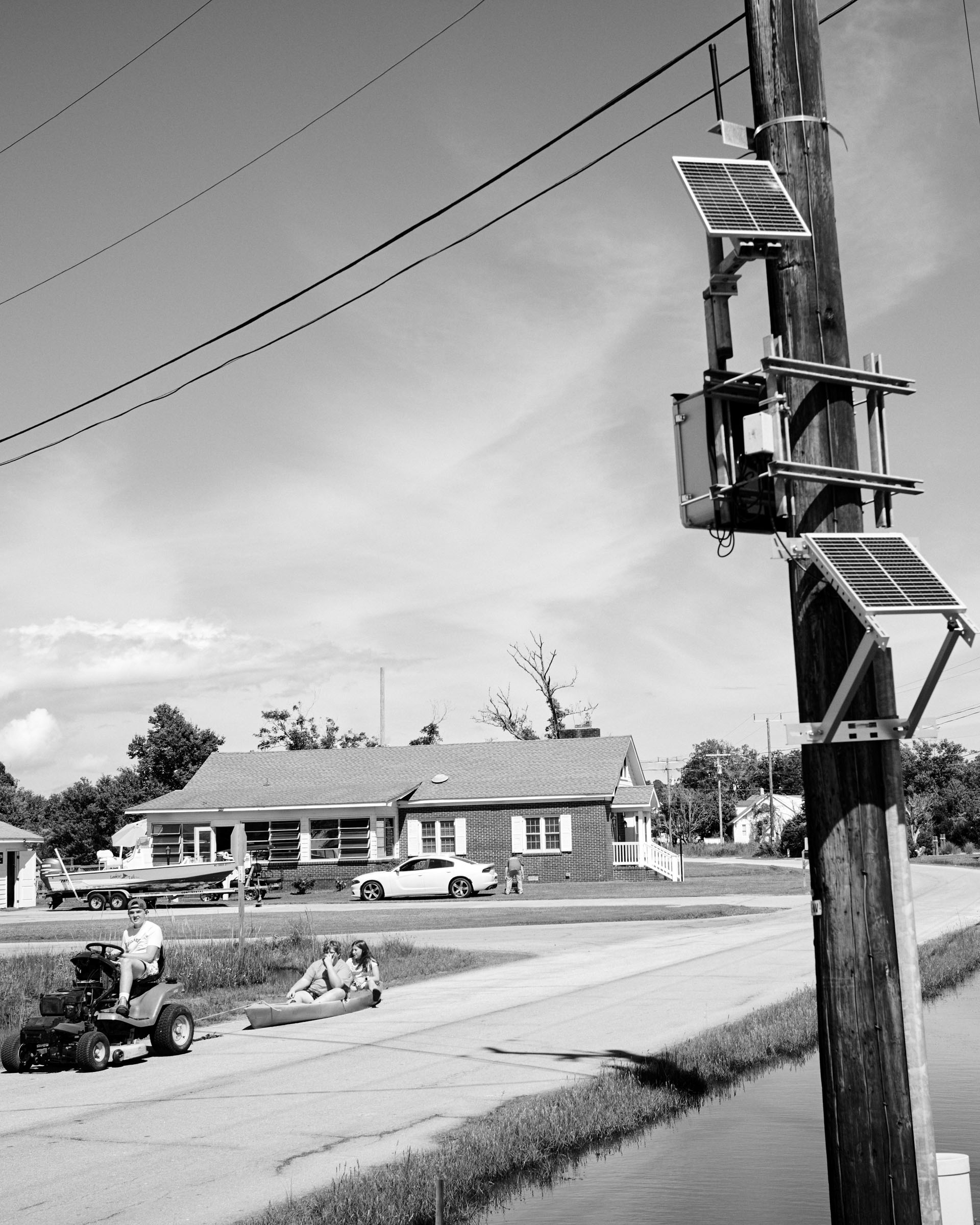
In Harkers Island, N.C., a solar-powered device on a utility pole monitors coastal flooding. “It doesn’t take extreme conditions to cause flooding anymore,” says Miyuki Hino, a researcher on the federally funded Sunny Day Flooding Project. “They can get flooding from just routine changes in water level and rain that wouldn’t have caused flooding 100 years ago, but it is today.” —Lon Tweeten for TIMEAnn Mann sits outside her home, which at the time was in the process of being pulled apart. Water often pooled under the house, causing the floorboards to rot. Placing it on stilts took months, but in May she returned. “I feel good, I feel happy, I feel joyful,” she said about her return. “I’m higher up in the air.”
Hyde County is, on a per capita basis, amongst one of the [U.S. counties] most threatened by rising water levels. So it is really ground zero for a lot of the impacts that we’re seeing.
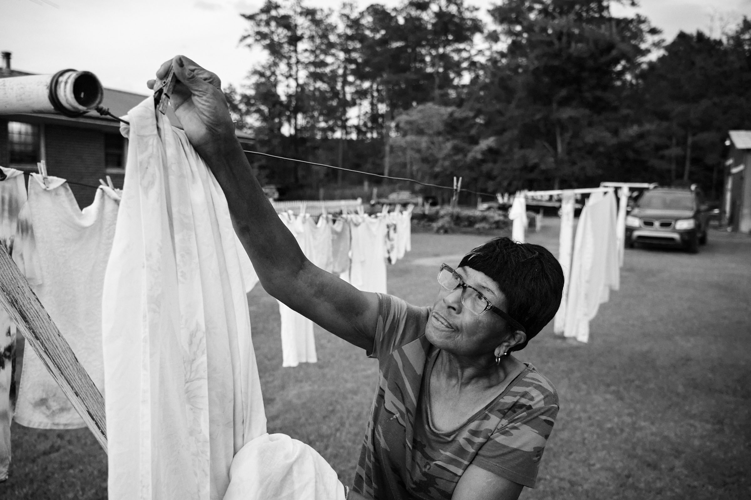
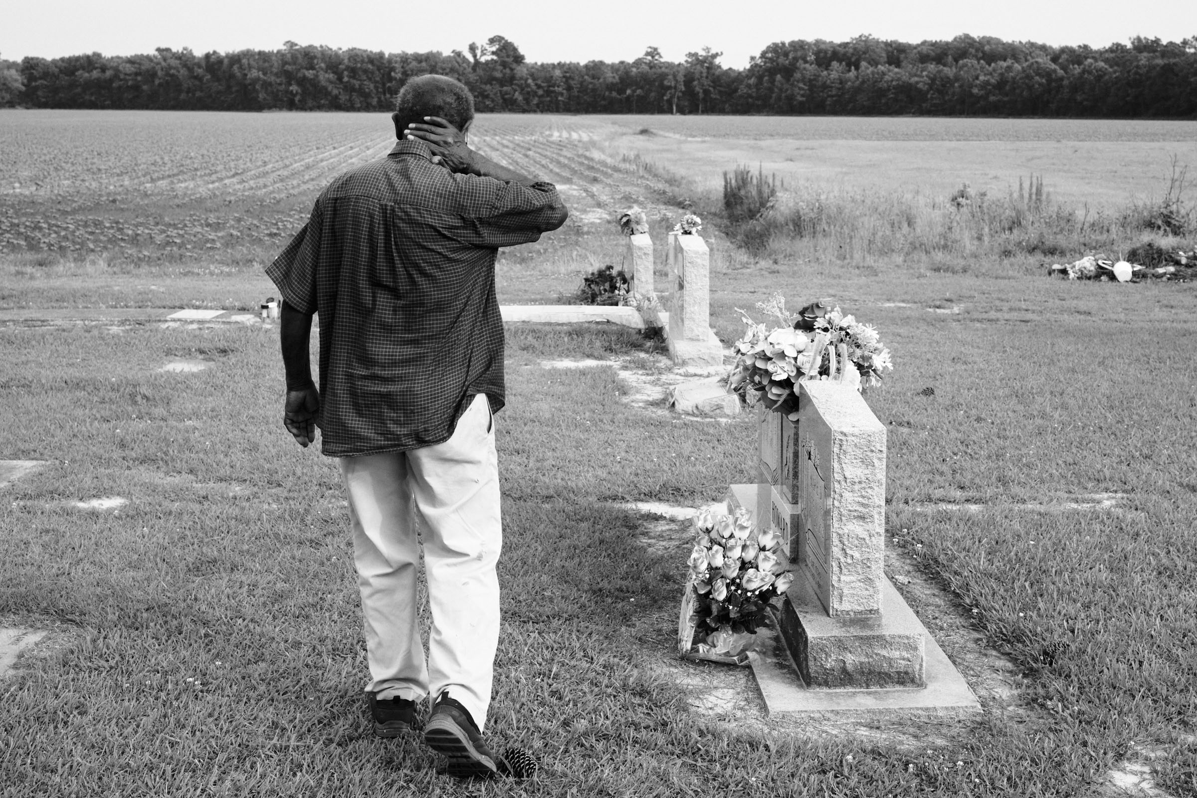
—Sara Ward, Director of the Atlantic Conservation CoalitionSenorita looks through an old photo album—filled with memories of a lifetime of family gatherings, and their children playing in the yard.Senorita Howard washes dishes after breakfast, keeping an eye out on the yard, which is where the water first begins to rise.Senorita Howard pulls clothes off a line after noticing storm clouds. “It’s kind of hectic trying to move stuff, trying to keep watching that water and see how high it gets.”Scranton Creek feeds into the Pungo River and often floods the yards of nearby residents when water begins to rise.Lelon Howard stands at his family cemetery where his parents, youngest daughter, and oldest son are buried in Scranton, North Carolina.
Everybody is really friendly. They still come by and see you just like they did in the old days.
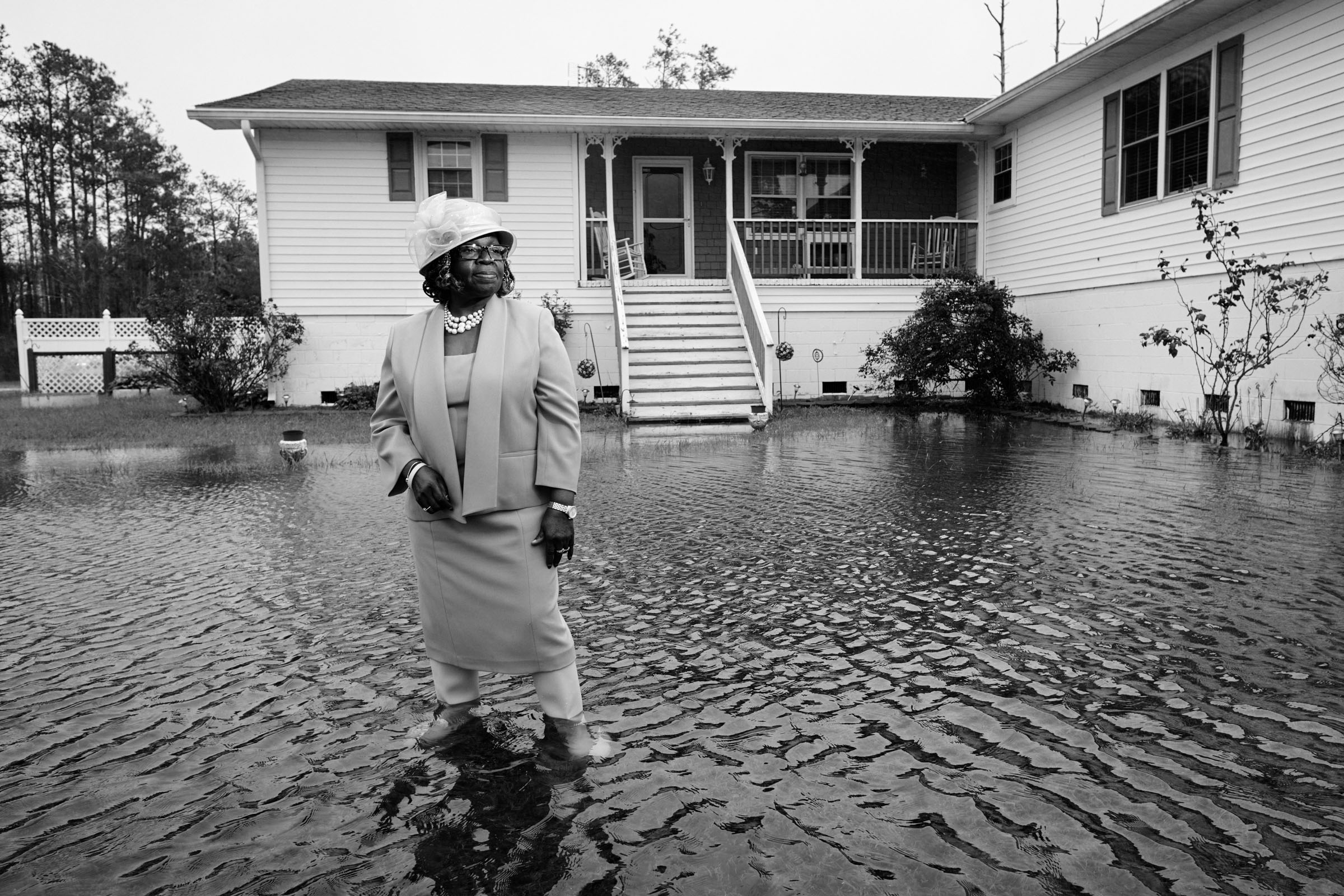
—Senorita Howard, Scranton residentLovie Miller stands outside her home during a king tide. She lives next to Scranton Creek, and says it’s impossible to predict when the waters might roll in. As sea levels rise, high-tide flooding, also known as king tides or sunny day flooding, is occurring more often in coastal communities. Nationwide, the frequency has doubled since 2000 and is forecast to reach two to three times the current level by 2030.Lovie Miller (center) cooks oyster fritters, fish, and other dishes for friends at her home, which typically sees higher water levels than her neighbors. “I get the worst,” she says.Lovie Miller walks through her home, October 8, 2025.
I had just bought the house in ’98. By ’99 the flood came in my house—18 inches, flooded me right out.
—Lovie Miller, Scranton residentAnn Mann, a life-long resident in Scranton and a volunteer at the BRACE Community Outreach, prays over food before it’s distributed to those in need. Scranton, along with most of Hyde County, is considered a food desert, with the nearest grocery store located miles away.
Normally, I leave and go to a higher ground, and you don’t know what you come back home to.
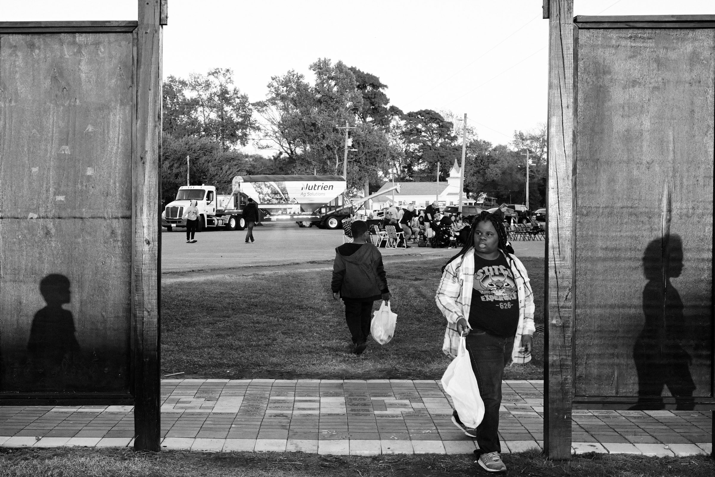
—Lovie Miller, Scranton residentPeople from across Hyde County visit Swan Quarter, located 10 miles east of Scranton, for Farm Days, an annual tradition that celebrates the region’s deep agricultural ties. Residents say that the number of farms in Scranton is on the decline. “You don’t see farms,” says Lovie Miller. “If you see them, they’re far away, not around here.”Hyde County residents gather in Fairfield, N.C., a town a few miles from Scranton for a “family and friends day.” Because Scranton no longer has its own grocery store, residents travel to neighboring towns for basic necessities, but are always drawn home.“Everybody in the community would look out for each other,” says Ann Mann.A crop-dusting airplane flies over a farm drainage canal in Scranton. The canal collects water from saltwater flooding that’s a growing problem for farmers on coastal land, making soil more saline and unable to sustain crops.Linda Davis and Ella Davis work as produce graders at Mattamuskeet Fresh Produce, one of a few employers in the area. A flood can derail a workday for many, blocking roadways or rendering driveways inaccessible.
We would go to places like Greenville, Raleigh, places like that. But now, over the years you’re finding out those places flood too. Now, we stay where we are, most of us. We don’t evacuate, we don’t go any place. The majority of Scranton people, we stay here and ride it out.
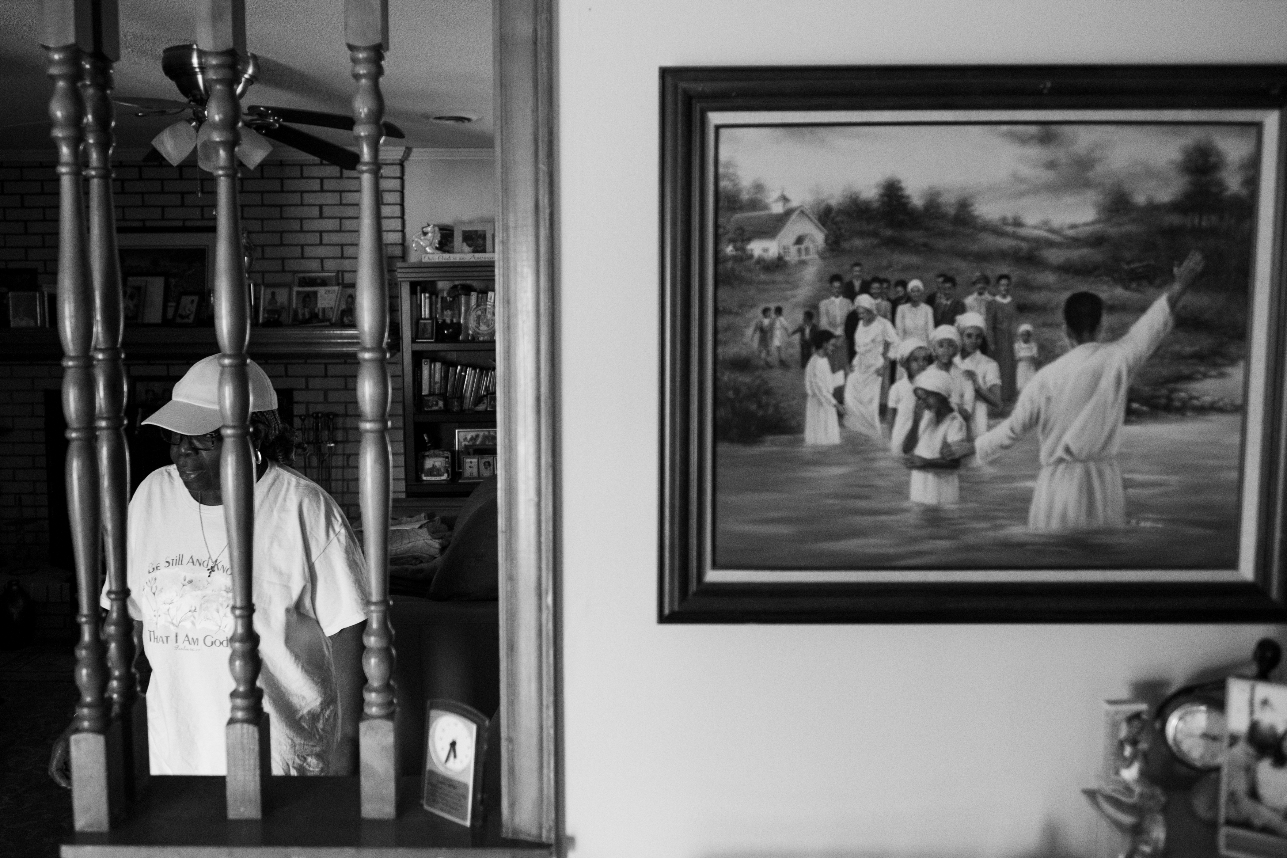
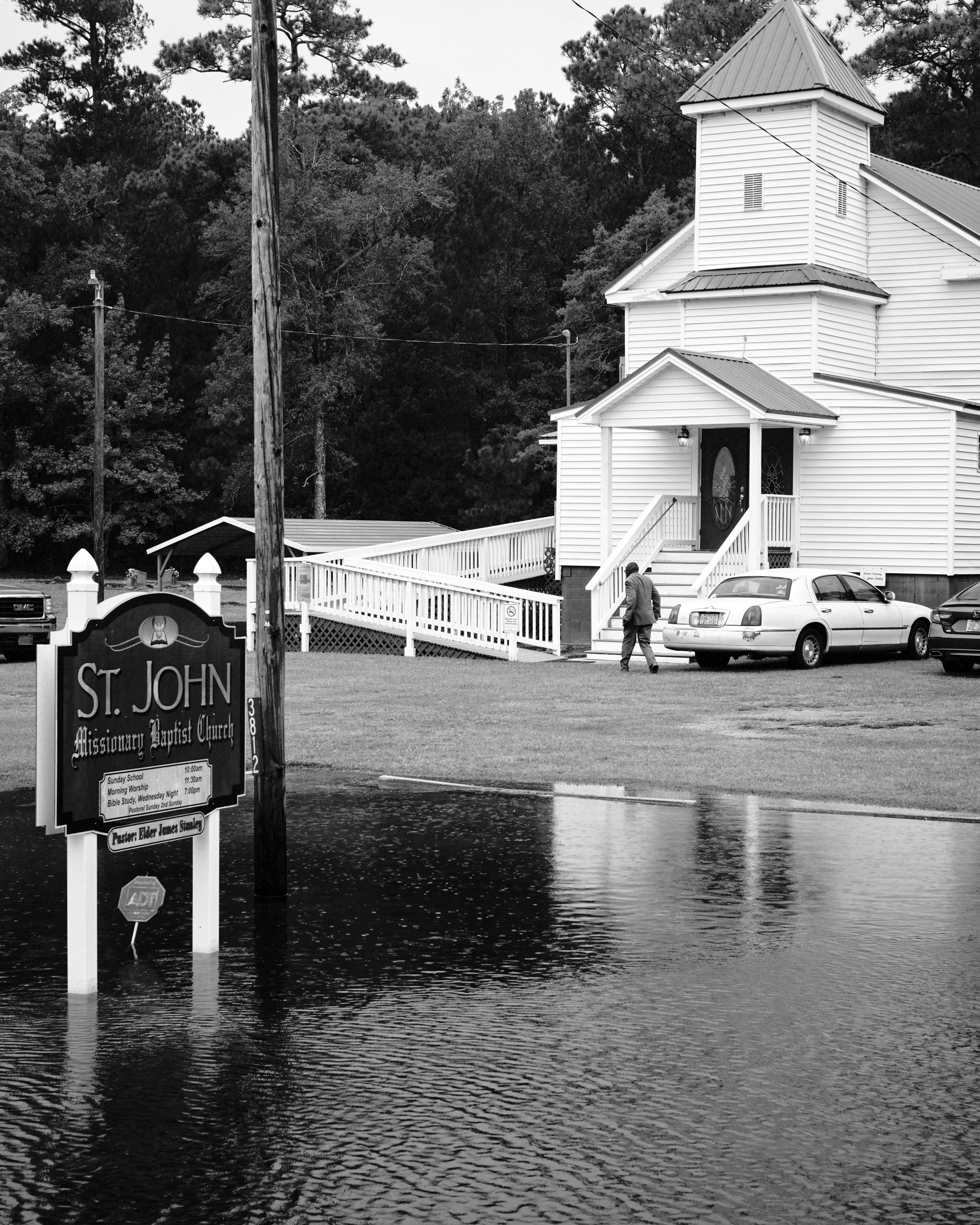
—Ann Mann, Scranton residentFlood waters from a king tide surround St. John’s Missionary Baptist Church during a homecoming service to celebrate their 150th anniversary on Oct. 12, 2025. Churches in Scranton used to be a gathering place for residents during flooding events, but no longer. “The church isn’t safe anymore,” says Ann Mann. “We have had churches in our area flood out, and never [go] back to be a church again.”Congregants at Mt. Pilgrim Church of Christ in Scranton participate in foot washing on Communion Sunday. A tradition that runs deep in Southern Black Pentecostal churches, the ritual disappeared in many places after COVID disrupted in-person activities.Members at Mt. Pilgrim Church of Christ participate in the tithes and offering part of the service during a Communion Sunday.
It can be really tricky to figure out the best way to mitigate this type of flooding. Water goes where it wants to go.
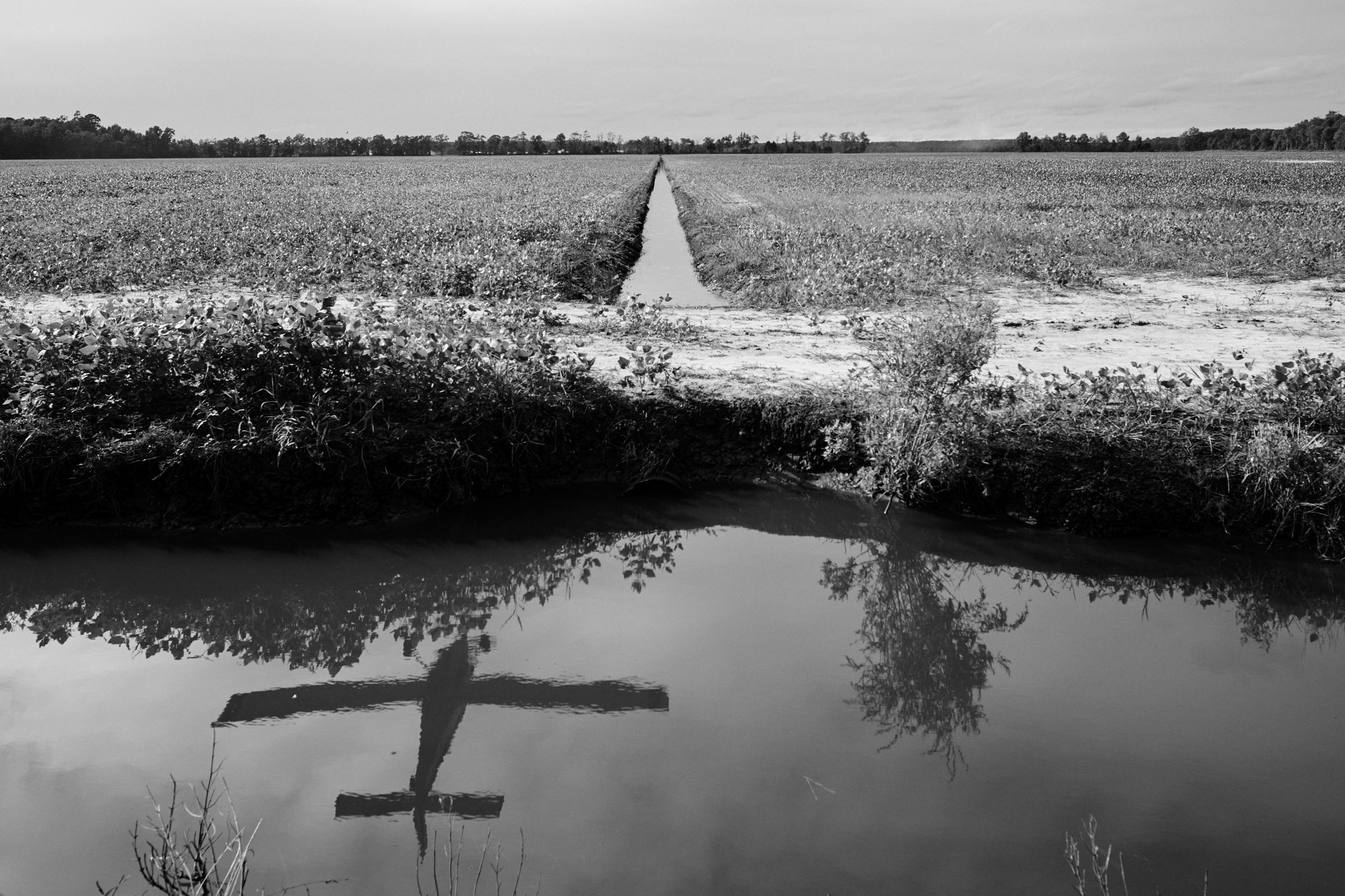
—Miyuki Hinho, Associate professor in the Department of City and Regional Planning at the University of North Carolina at Chapel HillA family cemetery is inundated with water during a king tide flood on Oct. 12, 2025. The cemetery sits to the left of Zion Temple Baptist Church, which is no longer in use, but was once the organizational hub for one of the longest-running protests for school desegregation.